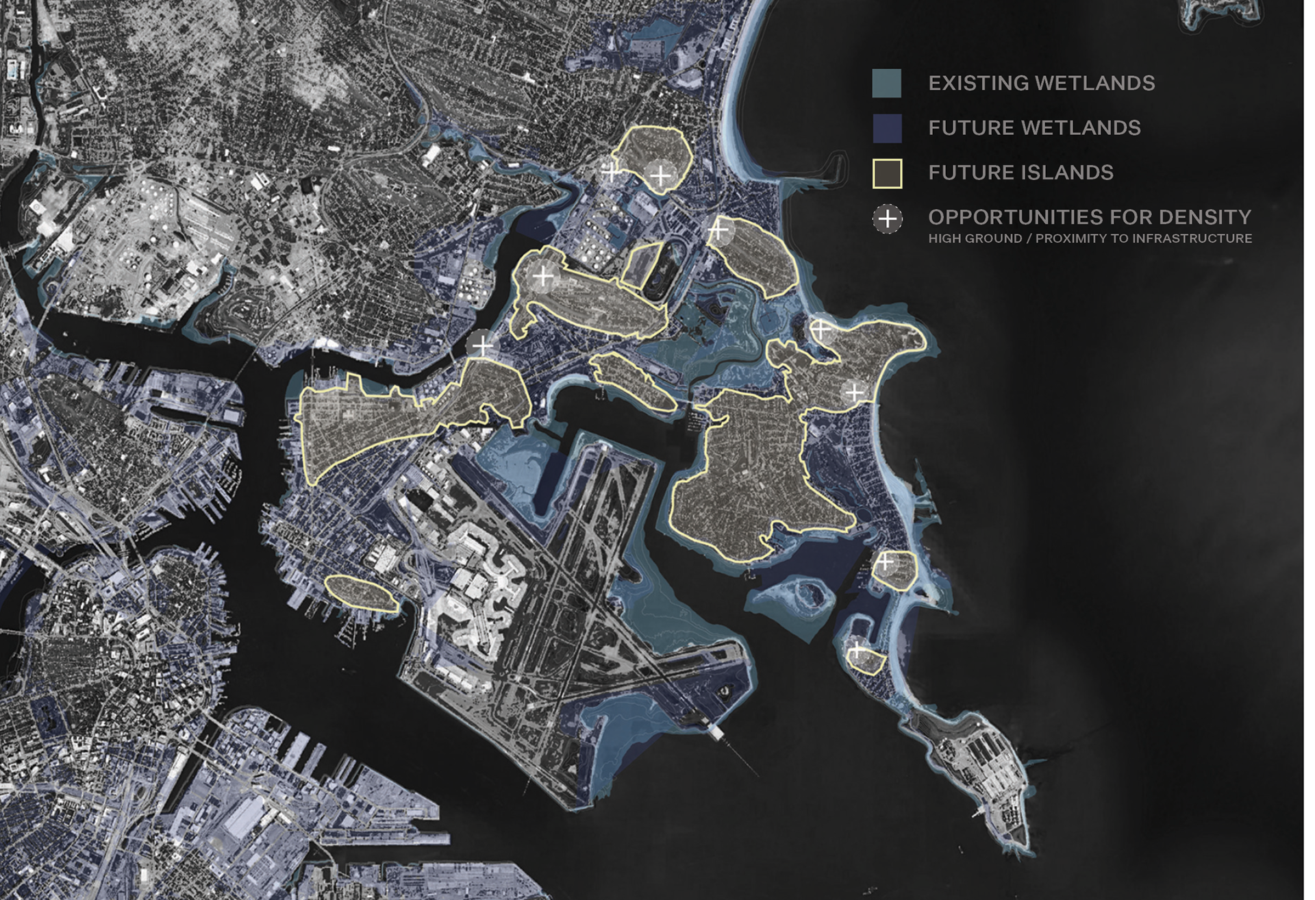
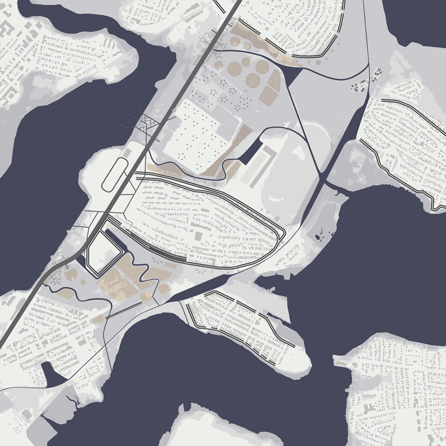
The new inundated landscape of East Boston and opportunities for densification defined by high ground and access to infrastructure
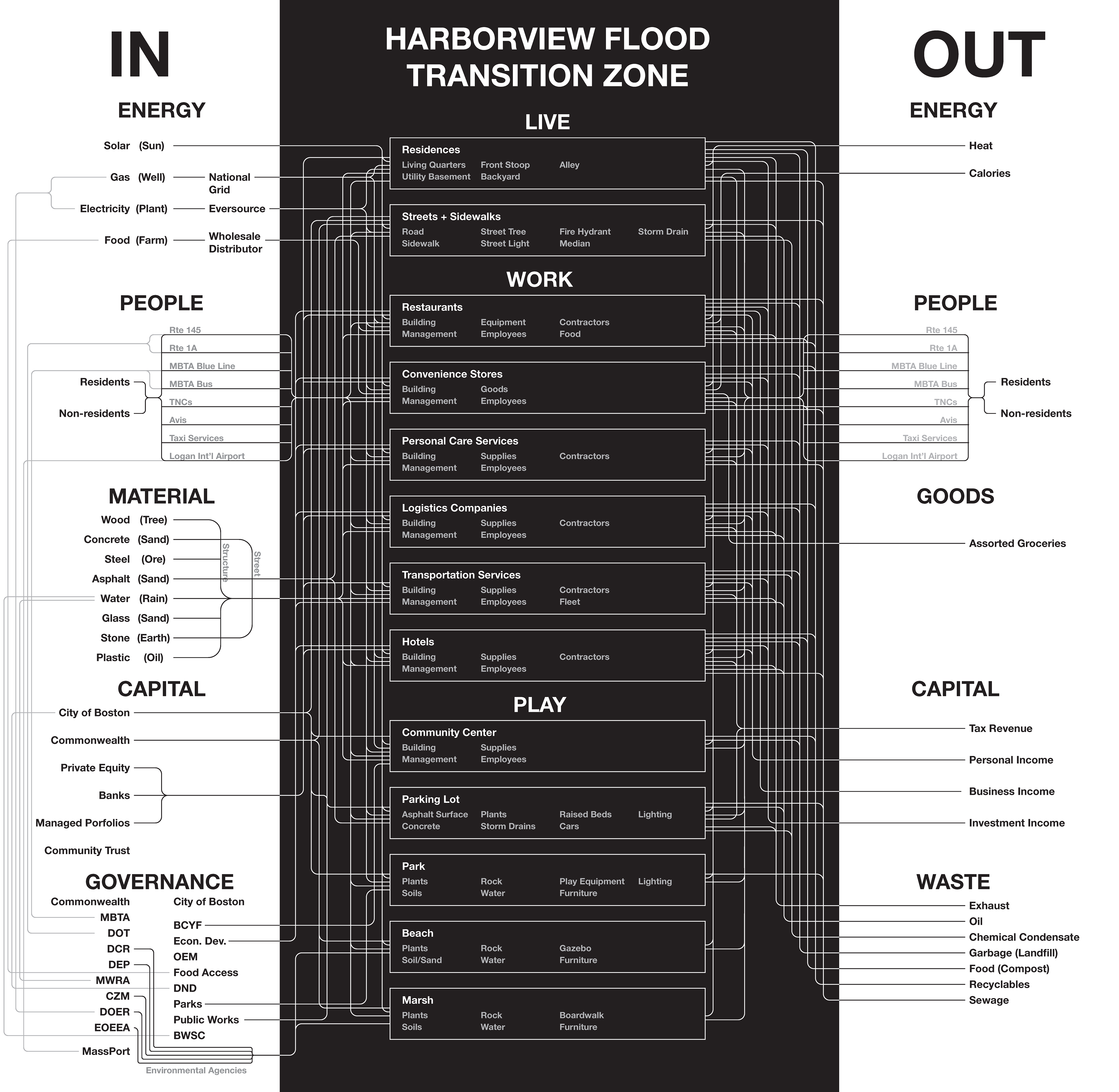
Existing stakeholders and urban metabolism of the Harborview area of East Boston

Selections from the Harborview urban catalog
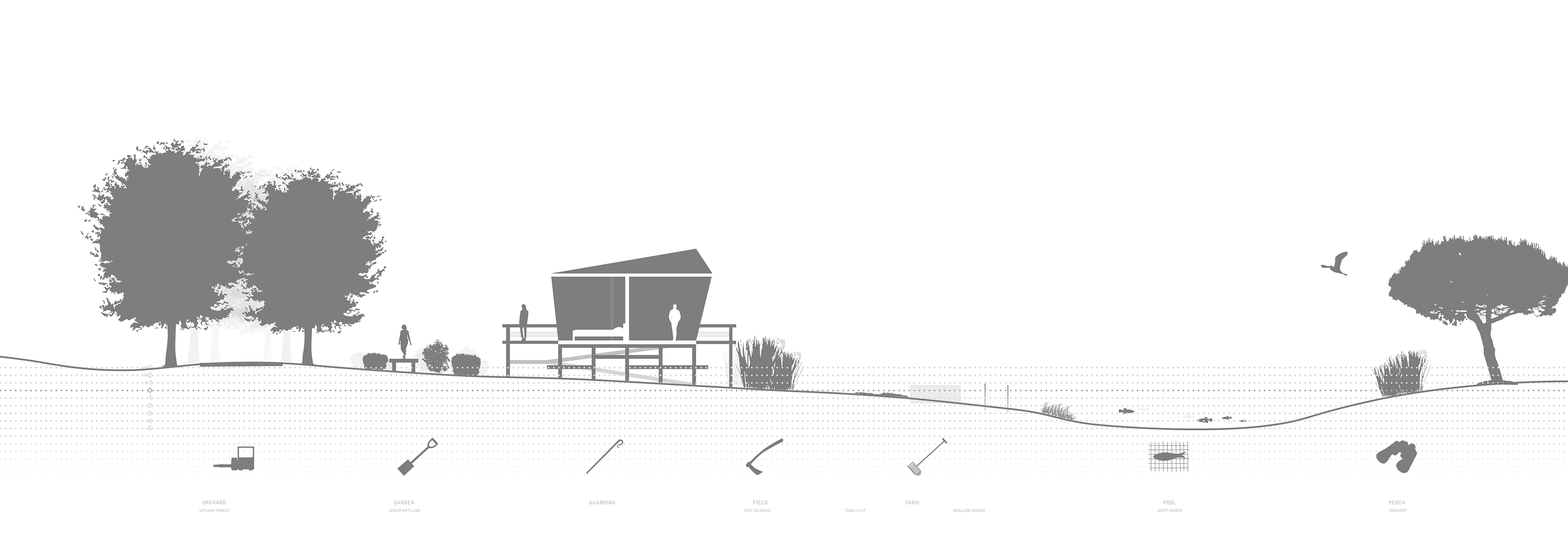
East Boston wetland cooperative "valley section"

Remediation and redevelopment of the inundated industrial landscape

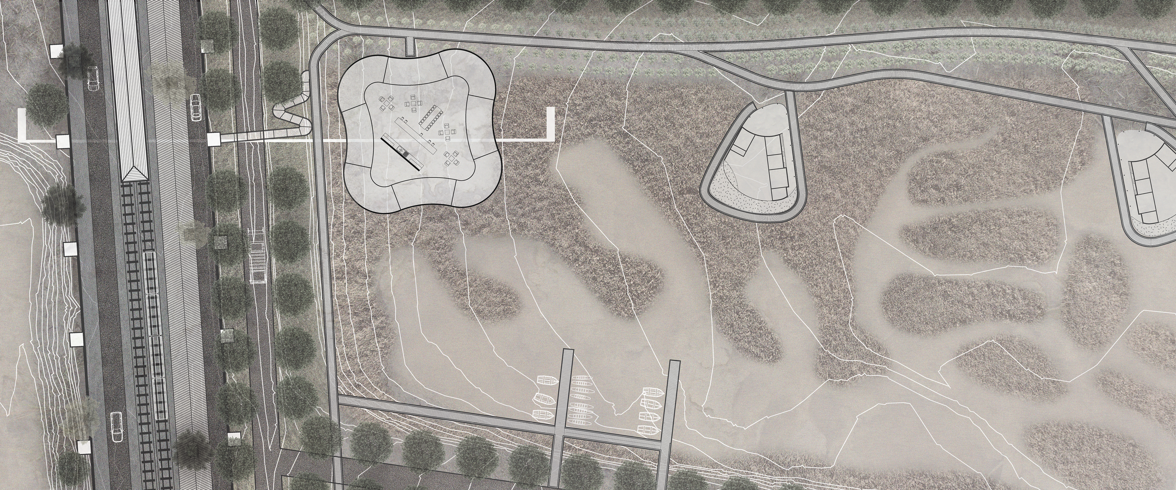
Key to the project is a residential working wetland, connected by logistical roadways and pedestrian boardwalks
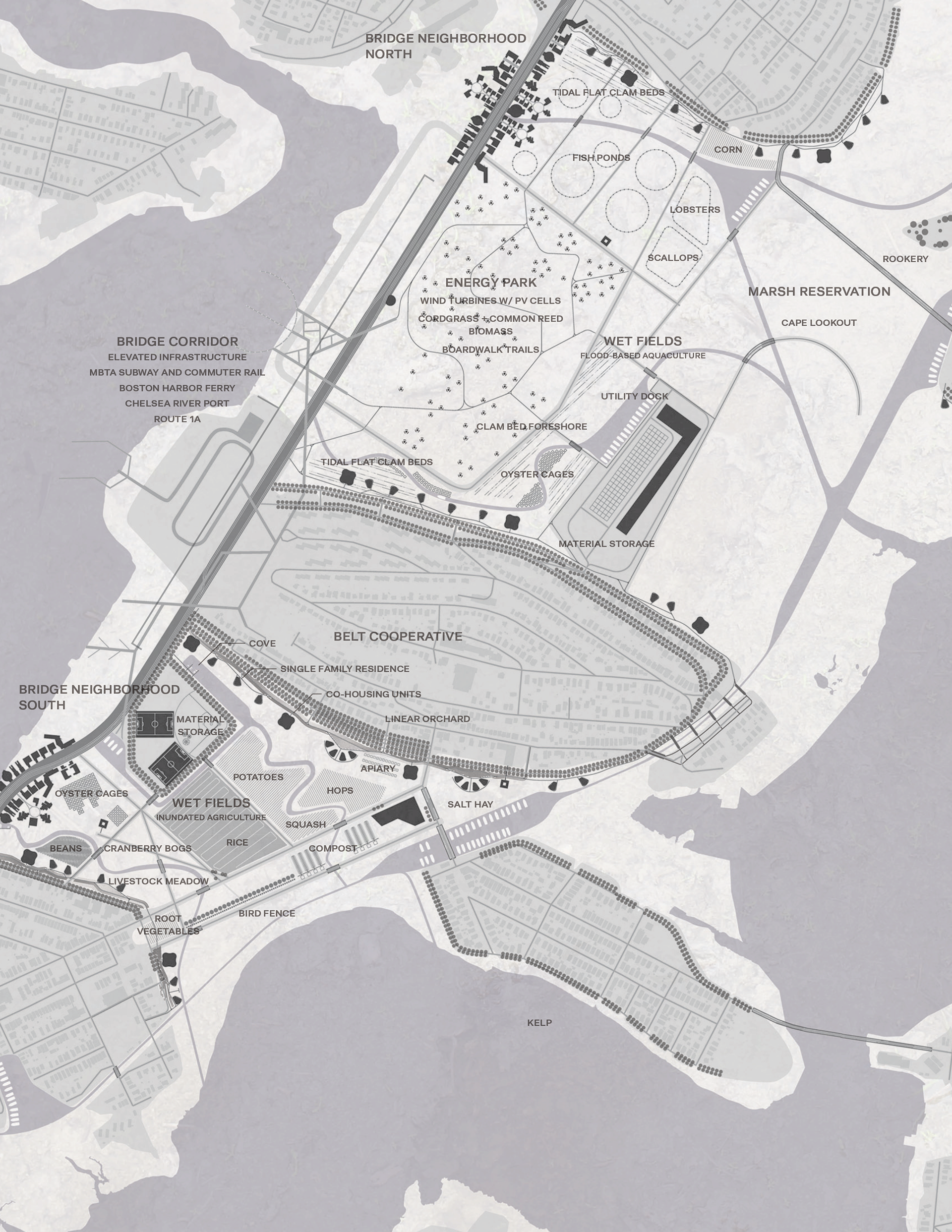
Site plan for the project at 2070 showing the relationship of all planned residential, productive, and infrastructural uses
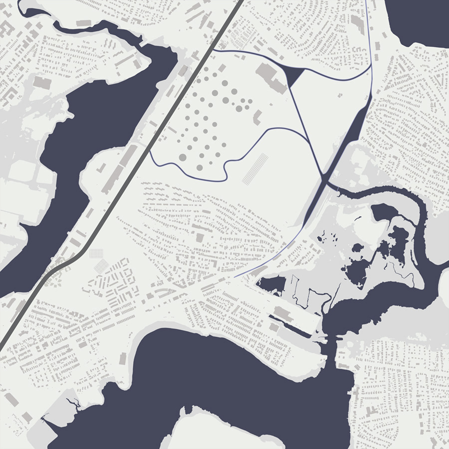
2030
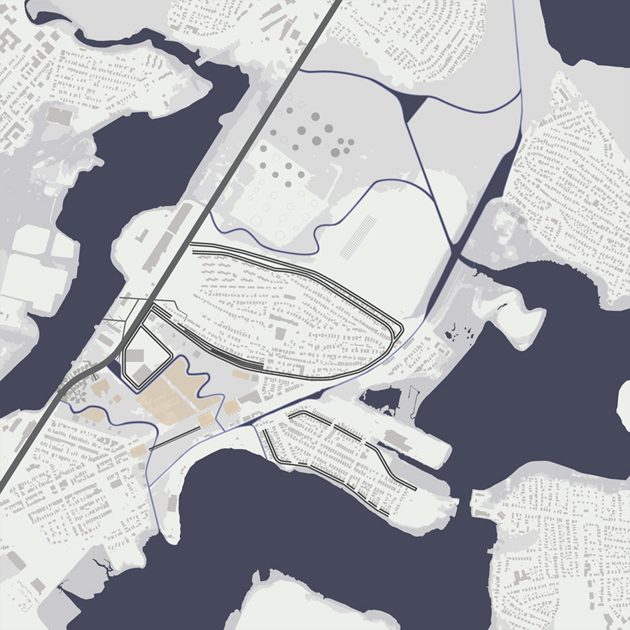
2050
2070
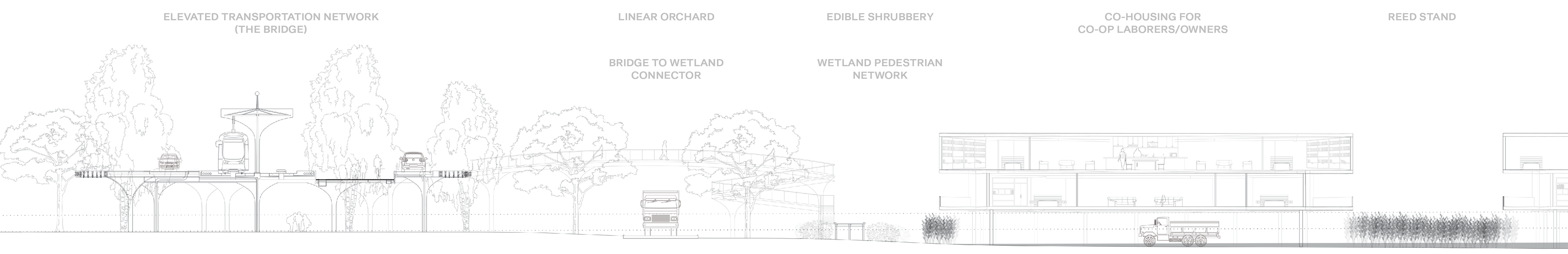
This plan and section pair shows the relationship of the elevated and embedded cities and the application of the diagrammatic “valley section” to the proposed build, including the various sites of production, recreation, and residential life and the logistical networks that connect them.